
Odesa
ICAO: UKOO
IATA: ODS
Elev: 171 ft
FIR: UKOV Odesa
Координати:
46°25′36.00″N 30°40′35.00″E
Міжнародний аеропорт «Одеса» – один із найбільших в Україні, розташований за 7 км від центру міста. Має сучасний термінал, відкритий у 2017 році, і нову злітно-посадкову смугу. До повномасштабної війни активно обслуговував внутрішні та міжнародні рейси.
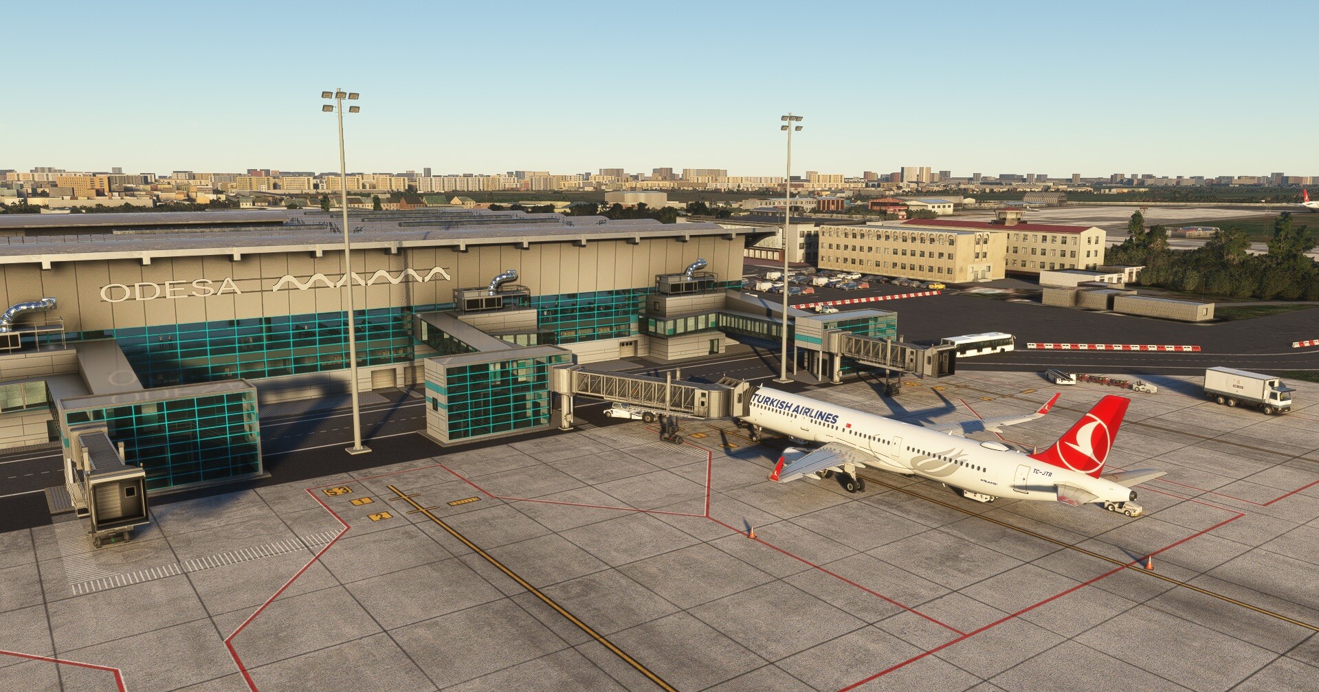
© Screenshot by: UA-EC Andrii
Quick links
Швидкі посилання:
Злітно-посадкові смуги
16
156°
9 186 x 148 ft
2 800 x 45 m
Elev: 174 ft
Slope: -0.10°
3 kts
9 kts
34
336°
9 186 x 148 ft
2 800 x 45 m
Elev: 164 ft
Slope: 0.10°
3 kts
9 kts
Погода
Overcast

26 C°
325°
5 м/c | 10 kts
Пориви вітру
до 13
м/c | 25 kts
Тиск
1010 hpa
Видимість
10+
км
Опади
0 мм
Вологість
35%
Хмарність
98%
13 хвилин тому
METAR
UKOO 081430Z 25014KT CAVOK 28/13 Q1019
TAF
                    UKOO 081430Z 0815/0915 24013KT CAVOK

            BECMG 0817/0820 VRB02KT

            BECMG 0909/0912 09010KT
ATC
За попередні 24 години
| Позиція | ATIS | Частота | Тривалість | Диспетчер | Онлайн |
|---|---|---|---|---|---|
| UKOV_CTR |
ts-1.eu-west-2.ivao.aero/UKOV_CTR
TL FL110 TA 10000ft RMK UKOO 040618Z 35018KT 9999 FEW040 SCT141 22/14 Q1013
04.07.2026 10:14 UTC
|
132,200 MHz |
3
г.
37
хв.
|
2 години тому 2г тому | |
| UKOO_TWR |
ts-1.eu-west-2.ivao.aero/UKOO_TWR
Odesa ATIS Information BRAVO recorded at 0802z ARR RWY 34 DEP RWY 34 TL FL120 TA 10010ft RMK ENGLISH ONLY RADIOTELEPHONY COMMUNICATION QNH 1011 CONFIRM ATIS INFO BRAVO on initial contact
04.07.2026 09:35 UTC
|
125,500 MHz |
1
г.
35
хв.
|
2 години тому 2г тому | |
| UKBU_CTR |
ts-1.eu-west-2.ivao.aero/UKBU_CTR
TL FL110 TA 10010ft RMK ENGLISH ONLY RADIOTELEPHONY COMMUNICATION / UKBB DEP 36R 36L ARR 36R QNH 1009 EXPECT WHISKEY ARRIVAL / UKKK DEP 26 ARR 26 QNH 1009 / UKOO DEP 34 ARR 34 QNH 1007 / UKHH DEP 25 ARR 25 QNH 1007 / UKLL DEP 31 ARR 31 QNH 1016
03.07.2026 19:10 UTC
|
136,400 MHz |
1
г.
30
хв.
|
17 годин тому 17г тому | |
| UKBU_CTR |
03.07.2026 15:50 UTC
|
136,400 MHz |
1
г.
11
хв.
|
20 годин тому 20г тому |
IVAO NOTAMS
UA030024022022/22
All special operations flights are prohibited over the entire territory. All flights simulating military and civil SO are also prohibited over the entire territory. Users violating the IVAO Rules and Regulations can be subject to a suspension issued by a Network Supervisor or authorised administrator on behalf of the Executive Council.
Оновлено: 14.05.2026 00:00 UTC
UAWX004/24
MAXIMUM ALLOWED AIRCRAFT TYPE B772 / B77L
METAR NOT AVAILABLE. CHECK WEATHER INFORMATION ON
https://ua.ivao.aero/wx
Оновлено: 12.02.2025 09:00 UTC
Злітно-посадкові смуги
16
156°
9 186 x 148 ft
2 800 x 45 m
Elev: 174 ft
Slope: -0.10°
3 kts
9 kts
34
336°
9 186 x 148 ft
2 800 x 45 m
Elev: 164 ft
Slope: 0.10°
3 kts
9 kts
Погода
Overcast
26 C°
325°
5 м/c | 10 kts
Пориви вітру
до 13
м/c | 25 kts
Тиск
1010 hpa
Видимість
10+
км
Опади
0 мм
Вологість
35%
Хмарність
98%
13 хвилин тому
METAR
UKOO 081430Z 25014KT CAVOK 28/13 Q1019
TAF
                    UKOO 081430Z 0815/0915 24013KT CAVOK

            BECMG 0817/0820 VRB02KT

            BECMG 0909/0912 09010KT