
Kyiv/Boryspil
ICAO: UKBB
IATA: KBP
Elev: 427 ft
FIR: UKBV Kyiv
Coordinates:
50°20′41.00″N 30°53′36.00″E
Boryspil International Airport is the largest in Ukraine, located 29 km east of Kyiv. It serves as the country’s main air gateway, handling most international flights before 2022. The airport features modern infrastructure and multiple terminals, including Terminal D.
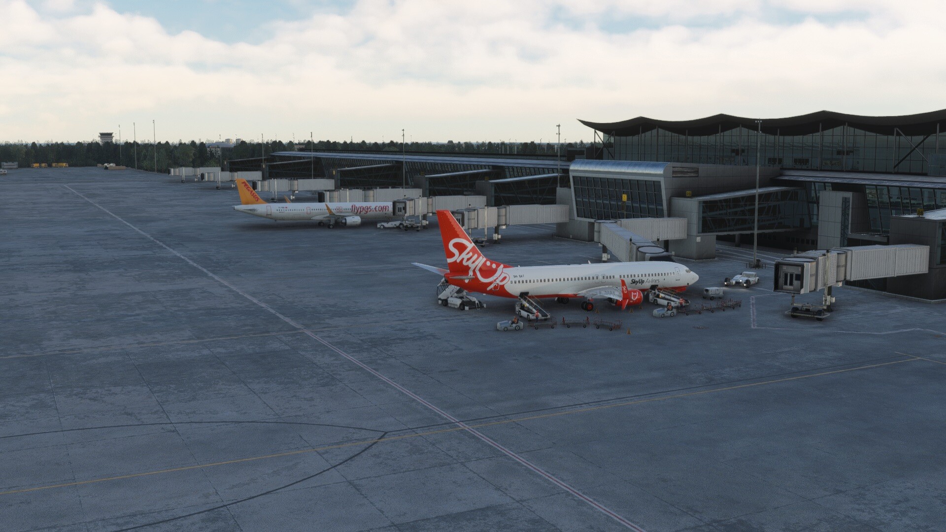
© Photo: Arne Müseler / arne-mueseler.com / CC-BY-SA-3.0
Quick links
Quick links:
Runways
18L
176°
13 123 x 197 ft
4 000 x 60 m
Elev: 410 ft
Slope: 0.09°
8 kts
5 kts
36R
356°
13 123 x 197 ft
4 000 x 60 m
Elev: 422 ft
Slope: -0.09°
8 kts
5 kts
18R
176°
11 483 x 207 ft
3 500 x 63 m
Elev: 419 ft
Slope: -0.13°
8 kts
5 kts
36L
356°
11 483 x 207 ft
3 500 x 63 m
Elev: 404 ft
Slope: 0.13°
8 kts
5 kts
Weather
Mainly clear

23 C°
304°
5 m/s | 9 kts
Wind gusts
up to 9
m/s | 18 kts
Pressure
1009 hpa
Visibility
10+
km
Precipitation
0 mm
Humidity
40%
Clouds
77%
15 minutes ago
METAR
UKBB 081430Z 25014KT CAVOK 28/13 Q1019
TAF
                    UKBB 081430Z 0815/0915 24013KT CAVOK

            BECMG 0817/0820 VRB02KT

            BECMG 0909/0912 09010KT
ATC
For the previous 24 hours
| Position | ATIS | Frequency | Duration | Controller | Online |
|---|---|---|---|---|---|
| UKBV_FSS |
NO VOICE/UKBV_FSS
04.07.2026 10:19 UTC
|
118,500 MHz |
0
h.
30
min.
|
4 hours ago 4h ago | |
| UKBB_1_TWR |
ts-1.eu-west-2.ivao.aero/UKBB_1_TWR
Boryspil ATIS Information CHARLIE recorded at 0938z ARR RWY 36 DEP RWY 36 RMK BKN035 Q1010 CONFIRM ATIS INFO CHARLIE on initial contact
04.07.2026 10:09 UTC
|
119,300 MHz |
0
h.
35
min.
|
4 hours ago 4h ago | |
| UKBU_CTR |
ts-1.eu-west-2.ivao.aero/UKBU_CTR
TL FL110 TA 10010ft RMK ENGLISH ONLY RADIOTELEPHONY COMMUNICATION / UKBB DEP 36R 36L ARR 36R QNH 1009 EXPECT WHISKEY ARRIVAL / UKKK DEP 26 ARR 26 QNH 1009 / UKOO DEP 34 ARR 34 QNH 1007 / UKHH DEP 25 ARR 25 QNH 1007 / UKLL DEP 31 ARR 31 QNH 1016
03.07.2026 19:10 UTC
|
136,400 MHz |
1
h.
30
min.
|
19 hours ago 19h ago | |
| UKBB_1_TWR |
ts-1.eu-west-2.ivao.aero/UKBB_1_TWR
Boryspil ATIS Information ALPHA recorded at 1754z ARR RWY 36R 36L DEP RWY 36R 36L TL FL120 TA 10010ft RMK ENGLISH ONLY RADIOTELEPHONY COMMUNICATION QNH 1009 CONFIRM ATIS INFO ALPHA on initial contact
03.07.2026 18:11 UTC
|
119,300 MHz |
0
h.
17
min.
|
20 hours ago 20h ago | |
| UKBU_CTR |
03.07.2026 15:50 UTC
|
136,400 MHz |
1
h.
11
min.
|
22 hours ago 22h ago | |
| UKBB_1_TWR |
ts-1.eu-west-2.ivao.aero/UKBB_1_TWR
Boryspil ATIS Information BRAVO recorded at 1442z ARR RWY 36R 36L DEP RWY 36R 36L TL FL120 TA 10010ft RMK ENGLISH ONLY RADIOTELEPHONY COMMUNICATION QNH 1009 CONFIRM ATIS INFO BRAVO on initial contact
03.07.2026 15:37 UTC
|
119,300 MHz |
1
h.
17
min.
|
22 hours ago 22h ago |
Flights
For the previous 24 hours
| Callsign | STS | Departure | Destination | Aircraft | Pilot | Online |
|---|---|---|---|---|---|---|
| SQP25F |
Approach
Altitude: 2853 ft
Speed: 249 kts
Heading: 188°
ETA: 14:33 utc
04.07.2026 14:30 UTC
|
UKBB
|
UKLL
|
B738 | Now | |
| UBE435 |
On Blocks
Altitude: 406 ft
Speed: 0 kts
Heading: 055°
04.07.2026 05:38 UTC
|
UKBB
|
LUKK
|
B738 | 8 hours ago 8h ago | |
| N125CD |
On Blocks
Altitude: 431 ft
Speed: 0 kts
Heading: 273°
04.07.2026 00:00 UTC
|
LKTB
|
UKBB
|
C25A | 14 hours ago 14h ago | |
| BRU845 |
On Blocks
Altitude: 413 ft
Speed: 0 kts
Heading: 270°
03.07.2026 18:36 UTC
|
UMMS
|
UKBB
|
B738 | 19 hours ago 19h ago | |
| SQP102 |
On Blocks
Altitude: 423 ft
Speed: 0 kts
Heading: 273°
03.07.2026 18:19 UTC
|
UKOO
|
UKBB
|
B738 | 20 hours ago 20h ago | |
| AUI893 |
On Blocks
Altitude: 668 ft
Speed: 0 kts
Heading: 319°
03.07.2026 18:19 UTC
|
UKBB
|
UMMS
|
B738 | 20 hours ago 20h ago | |
| BRU846 |
On Blocks
Altitude: 668 ft
Speed: 0 kts
Heading: 345°
03.07.2026 18:07 UTC
|
UKBB
|
UMMS
|
B738 | 20 hours ago 20h ago | |
| TRA973 |
On Blocks
Altitude: 361 ft
Speed: 0 kts
Heading: 081°
03.07.2026 17:50 UTC
|
UKBB
|
EPWA
|
A320 | 20 hours ago 20h ago | |
| AUI2M |
On Blocks
Altitude: 1051 ft
Speed: 0 kts
Heading: 046°
03.07.2026 15:20 UTC
|
UKBB
|
UKLL
|
B772 | 23 hours ago 23h ago | |
| TRA973 |
En Route
Altitude: 27201 ft
Speed: 459 kts
Heading: 049°
ETA: 14:58 utc
03.07.2026 14:54 UTC
|
LUKK
|
UKBB
|
A320 | 23 hours ago 23h ago |
IVAO NOTAMS
UA030024022022/22
All special operations flights are prohibited over the entire territory. All flights simulating military and civil SO are also prohibited over the entire territory. Users violating the IVAO Rules and Regulations can be subject to a suspension issued by a Network Supervisor or authorised administrator on behalf of the Executive Council.
Updated at: 14.05.2026 00:00 UTC
UAWX001/24
BE ADVISED THIS AIRPORT IS NOT APPROVED FOR CODE LETTER F AIRCRAFT (A380, OR SIMILAR) OPERATION. ATCO'S AUTHORISED TO REJECT FPL OR LANDING CLEARANCE AS PER SOP / AIP.
METAR NOT AVAILABLE. CHECK WEATHER INFORMATION ON https://ua.ivao.aero/wx
Updated at: 12.02.2025 09:00 UTC
Runways
18L
176°
13 123 x 197 ft
4 000 x 60 m
Elev: 410 ft
Slope: 0.09°
8 kts
5 kts
36R
356°
13 123 x 197 ft
4 000 x 60 m
Elev: 422 ft
Slope: -0.09°
8 kts
5 kts
18R
176°
11 483 x 207 ft
3 500 x 63 m
Elev: 419 ft
Slope: -0.13°
8 kts
5 kts
36L
356°
11 483 x 207 ft
3 500 x 63 m
Elev: 404 ft
Slope: 0.13°
8 kts
5 kts
Weather
Mainly clear
23 C°
304°
5 m/s | 9 kts
Wind gusts
up to 9
m/s | 18 kts
Pressure
1009 hpa
Visibility
10+
km
Precipitation
0 mm
Humidity
40%
Clouds
77%
15 minutes ago
METAR
UKBB 081430Z 25014KT CAVOK 28/13 Q1019
TAF
                    UKBB 081430Z 0815/0915 24013KT CAVOK

            BECMG 0817/0820 VRB02KT

            BECMG 0909/0912 09010KT