
Zaporizhzhia
ICAO: UKDE
IATA: OZH
Elev: 374 ft
FIR: UKDV Dnipro
Coordinates:
47°52′2.00″N 35°18′54.00″E
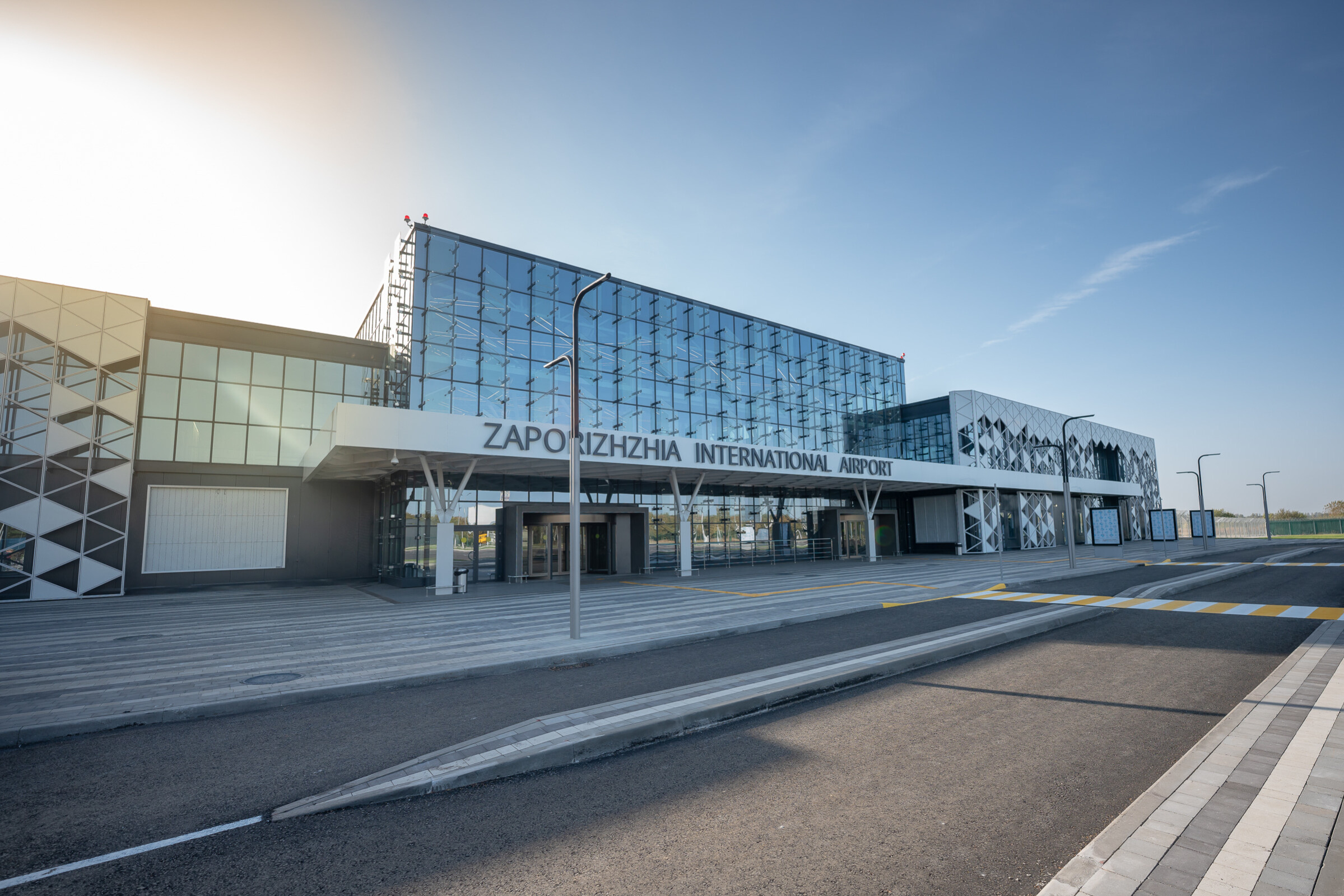
Zaporizhzhia International Airport is the city’s main air gateway, located 15 km from the center. A new terminal opened in 2020, improving passenger service. Before the war, the airport operated regular domestic and European flights.
Quick links
Quick links:
Runways
02
016°
8 209 x 138 ft
2 502 x 42 m
Elev: 339 ft
Slope: 0.40°
7 kts
6 kts
20
196°
8 209 x 138 ft
2 502 x 42 m
Elev: 373 ft
Slope: -0.40°
7 kts
6 kts
Weather
Overcast

24 C°
334°
5 m/s | 10 kts
Wind gusts
up to 11
m/s | 20 kts
Pressure
1006 hpa
Visibility
10+
km
Precipitation
0 mm
Humidity
65%
Clouds
100%
10 minutes ago
METAR
UKDE 081430Z 25014KT CAVOK 28/13 Q1019
TAF
                    UKDE 081430Z 0815/0915 24013KT CAVOK

            BECMG 0817/0820 VRB02KT

            BECMG 0909/0912 09010KT
Sceneries
ATC
For the previous 24 hours
| Position | ATIS | Frequency | Duration | Controller | Online |
|---|---|---|---|---|---|
| UKBU_CTR |
ts-1.eu-west-2.ivao.aero/UKBU_CTR
TL FL110 TA 10010ft RMK ENGLISH ONLY RADIOTELEPHONY COMMUNICATION / UKBB DEP 36R 36L ARR 36R QNH 1009 EXPECT WHISKEY ARRIVAL / UKKK DEP 26 ARR 26 QNH 1009 / UKOO DEP 34 ARR 34 QNH 1007 / UKHH DEP 25 ARR 25 QNH 1007 / UKLL DEP 31 ARR 31 QNH 1016
03.07.2026 19:10 UTC
|
136,400 MHz |
1
h.
30
min.
|
18 hours ago 18h ago | |
| UKBU_CTR |
03.07.2026 15:50 UTC
|
136,400 MHz |
1
h.
11
min.
|
21 hours ago 21h ago |
Runways
02
016°
8 209 x 138 ft
2 502 x 42 m
Elev: 339 ft
Slope: 0.40°
7 kts
6 kts
20
196°
8 209 x 138 ft
2 502 x 42 m
Elev: 373 ft
Slope: -0.40°
7 kts
6 kts
Weather
Overcast
24 C°
334°
5 m/s | 10 kts
Wind gusts
up to 11
m/s | 20 kts
Pressure
1006 hpa
Visibility
10+
km
Precipitation
0 mm
Humidity
65%
Clouds
100%
10 minutes ago
METAR
UKDE 081430Z 25014KT CAVOK 28/13 Q1019
TAF
                    UKDE 081430Z 0815/0915 24013KT CAVOK

            BECMG 0817/0820 VRB02KT

            BECMG 0909/0912 09010KT